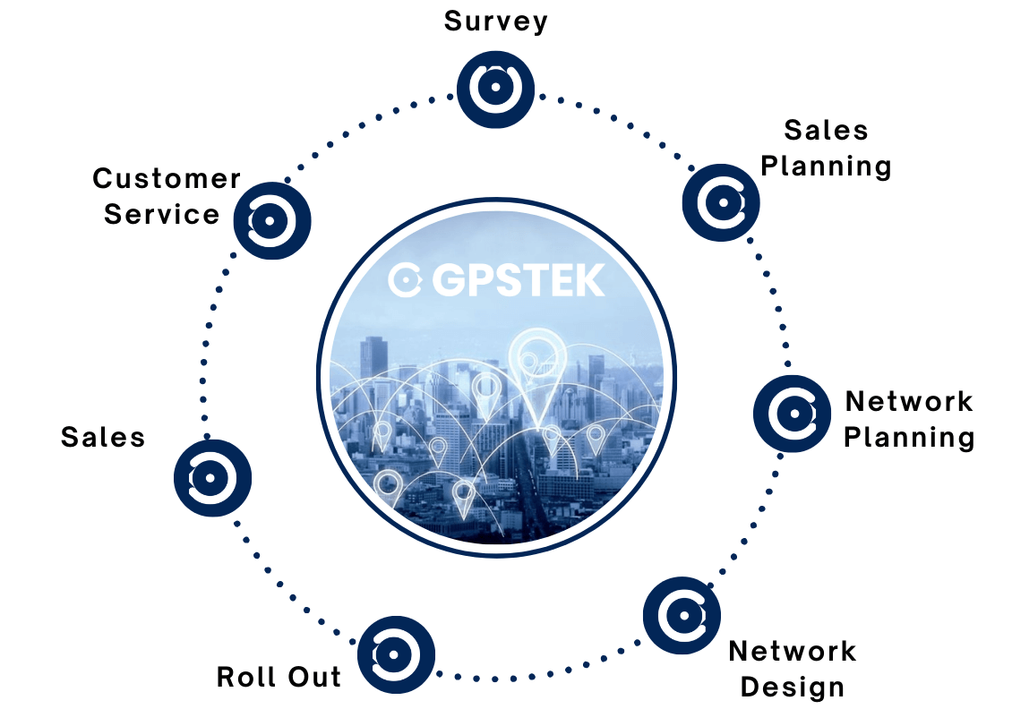
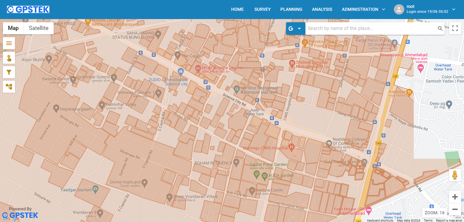
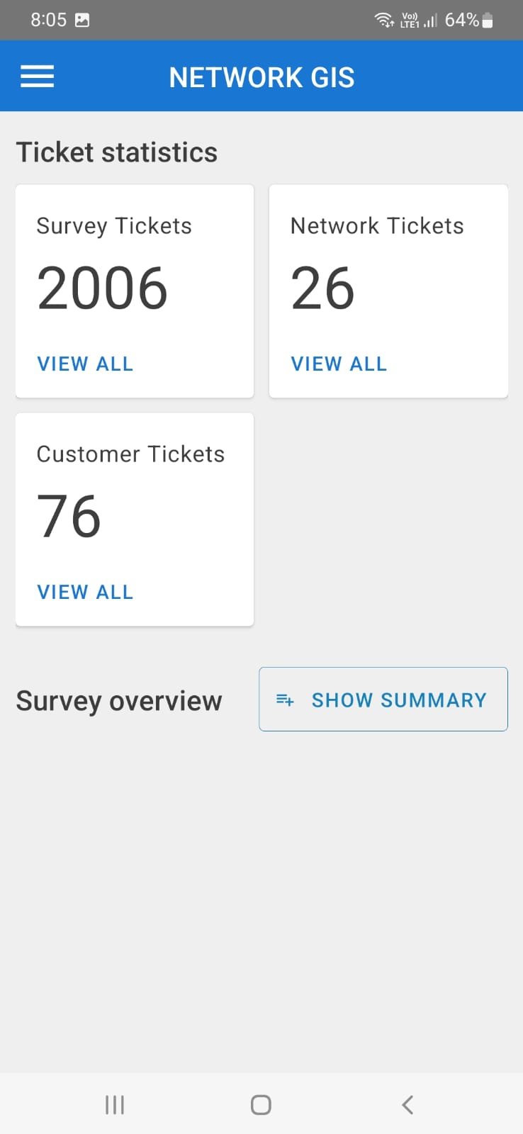
Web based application for visualizing your Network asset on map with their location along with predefined attributes. Along with same you can have the access of landbase and creation tool and related analytical features.
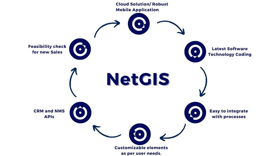
NetGIS: Scalable Software Architecture for Modern Needs
Harness the power of cloud technology and mobile integration for seamless operations.
Utilize cutting-edge coding practices to deliver reliable and efficient systems.
Our systems are designed for easy integration with existing business processes, ensuring smooth transitions.
Tailor our solutions to meet specific user requirements, offering flexibility and adaptability.
Integrate your customer relationship management and network management systems effortlessly.
Evaluate and ensure scalability and efficiency before adopting new sales strategies.
Land base Survey
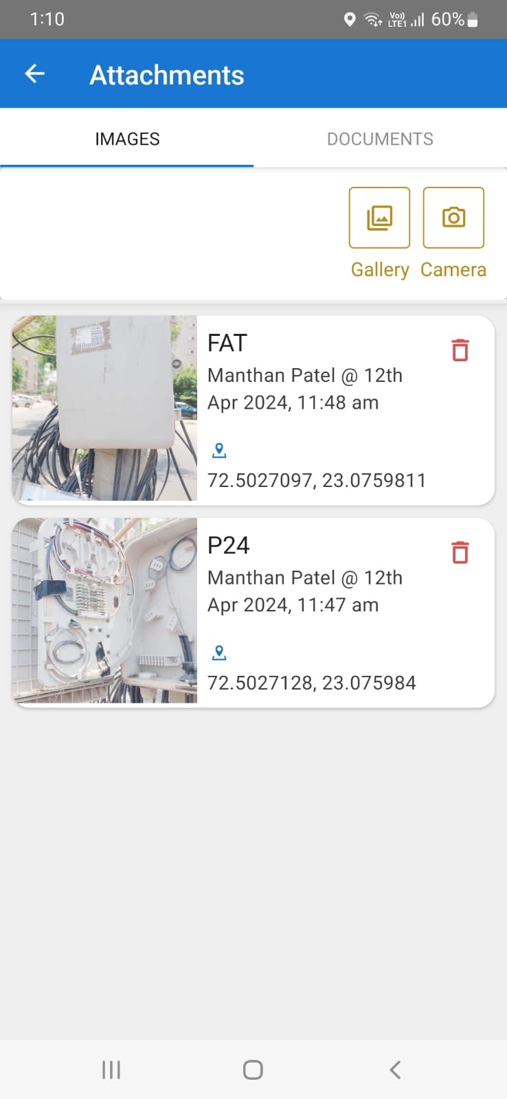
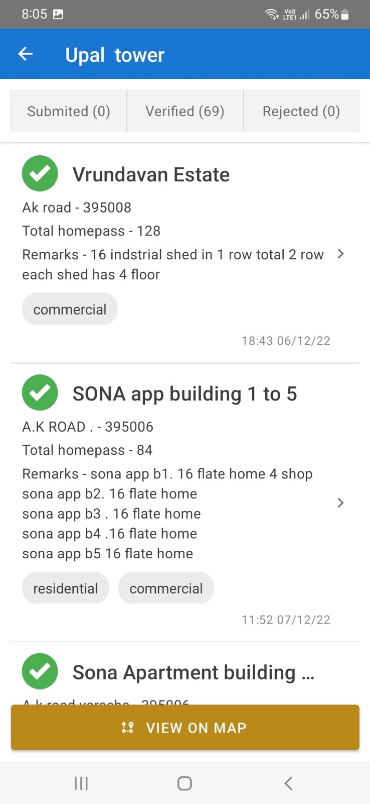
Robust tool for capturing field home pass data with customised survey form. It also allows user to validate the details before pushing same on live maps. Mobile application with reverse geo coding integration through Google APIs for error less data pulling.
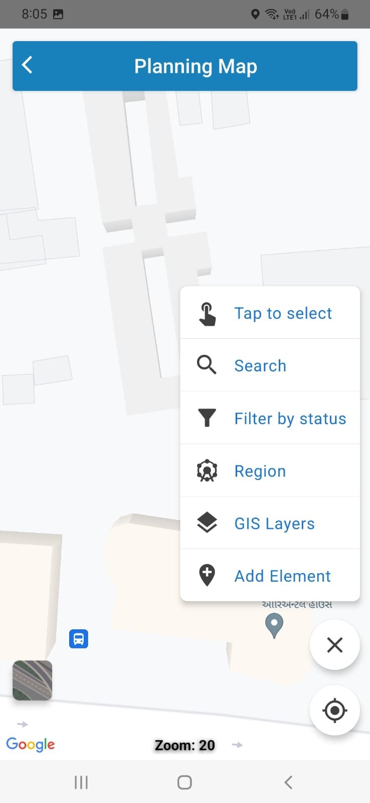
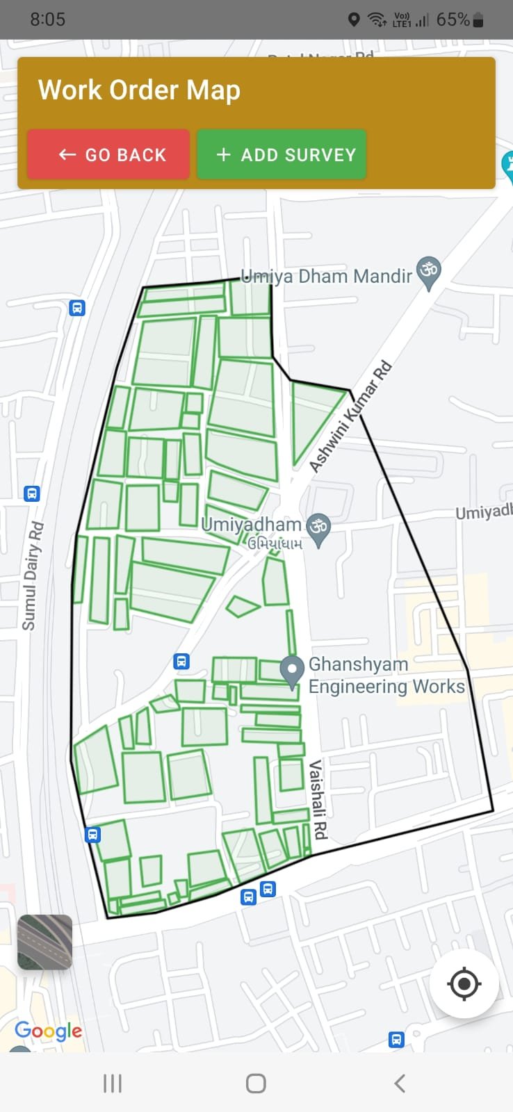
Region Management
Customisable boundary creation tool which allows users to create their custom boundary with parent child relationship. Admin can control the visibility of different users
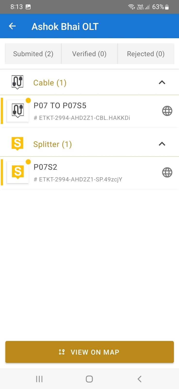
Element Creation
Defining passive and active inventory as per the standard requirements of user. User can add the variants of the inventory defined in the modules. ISP and OSP inventory modules with their logical connectivity architecture.
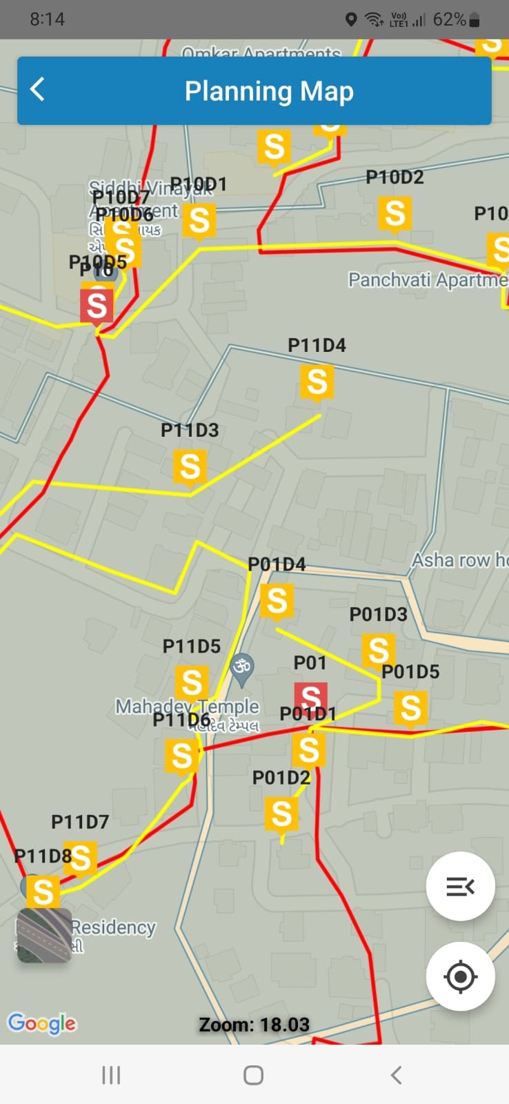
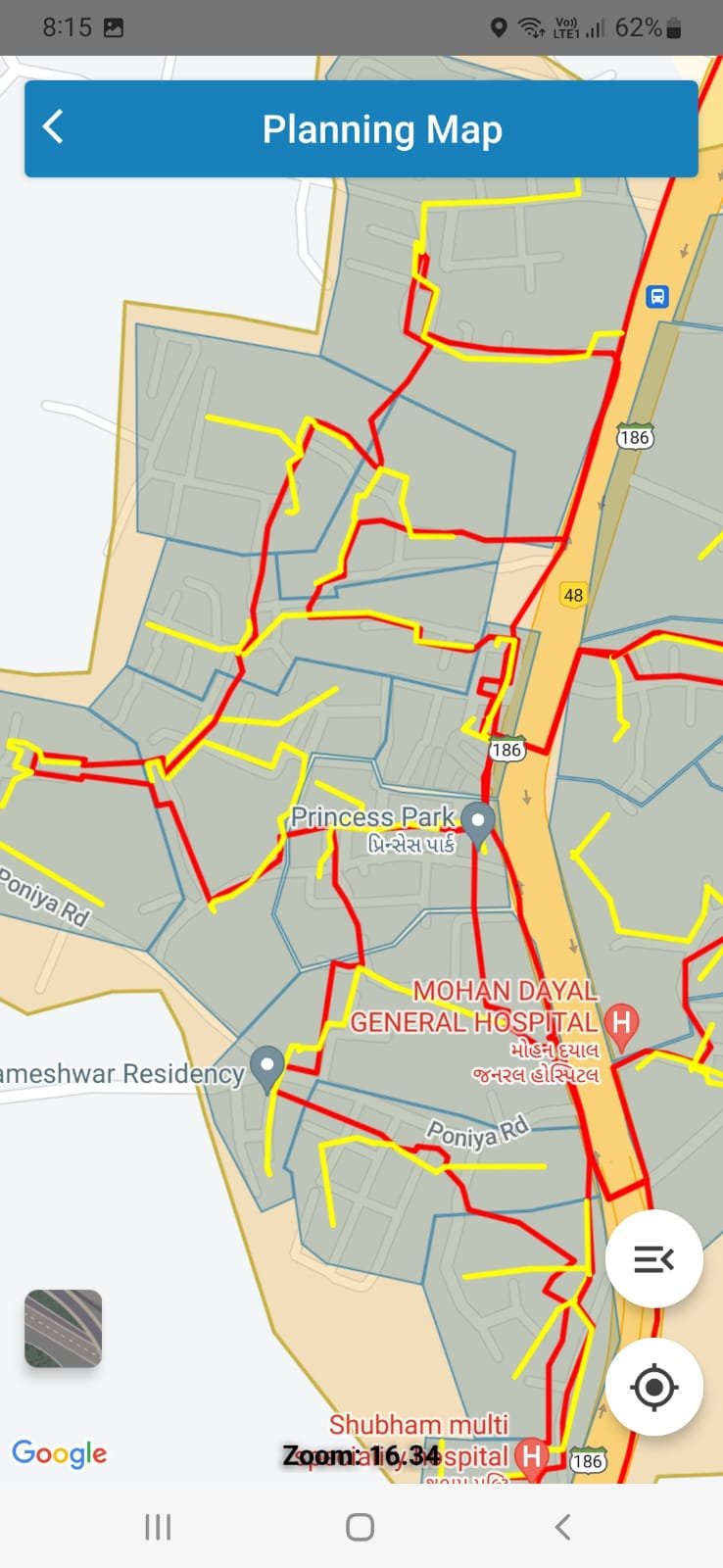
FTTx Design
Network planning and designing module which allow users to create FTTx design based on the defined criteria. In built validations configured as per network logics to avoid unforced error. Logical splicing tool with link budgeting option.
Network Feasibility
Based on the custom logic user can generate the feasibility with respect to various elements on the Map. Option to generate bulk feasibility through upload of excel or any other required format.
Data Analytics
Management reports and Heat Map representation for users to visualize the monetization of assets installed on the field. Integration through API with CRM and ERP applications to represent data attributes like sales, network uptime, service quality, and network utilization.
Land Base Creation
Land Base Creation
Web and Mobile application-based solution to capture the geographic survey which has one level validation stage. Mobile forms can be customised based on requirement
User friendly tool for creating boundaries based on requirements. Parent child relation can be built between different regions. It also supports upload functionality of shape and kml files.
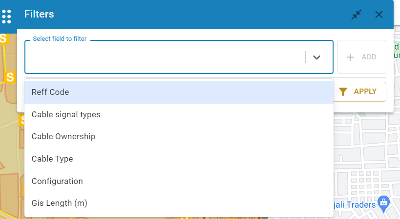
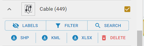
All the layers with elements have the customised labelling option which are configured for display on elements once it is enabled on Map. These labels are linked with certain zoom level to ensure the use case of labels. This tool also supports active map filtering which provide user and extensive option to check details on map based on various attributes of the elements
It also allows user to download the filtered elements in different format for further use.
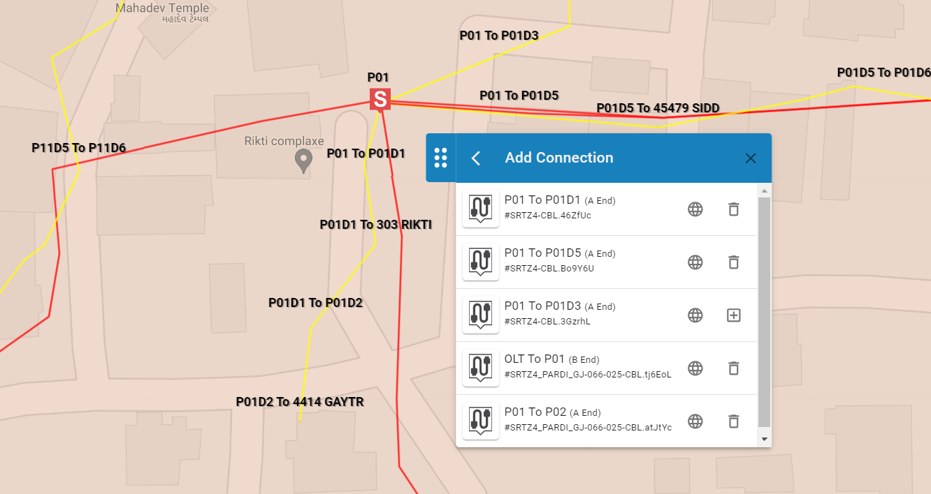
Connectivity Options
As per the user configuration, elements can be connected with one or multiple cables. User can also select Input and Output cable to do the logical splicing.
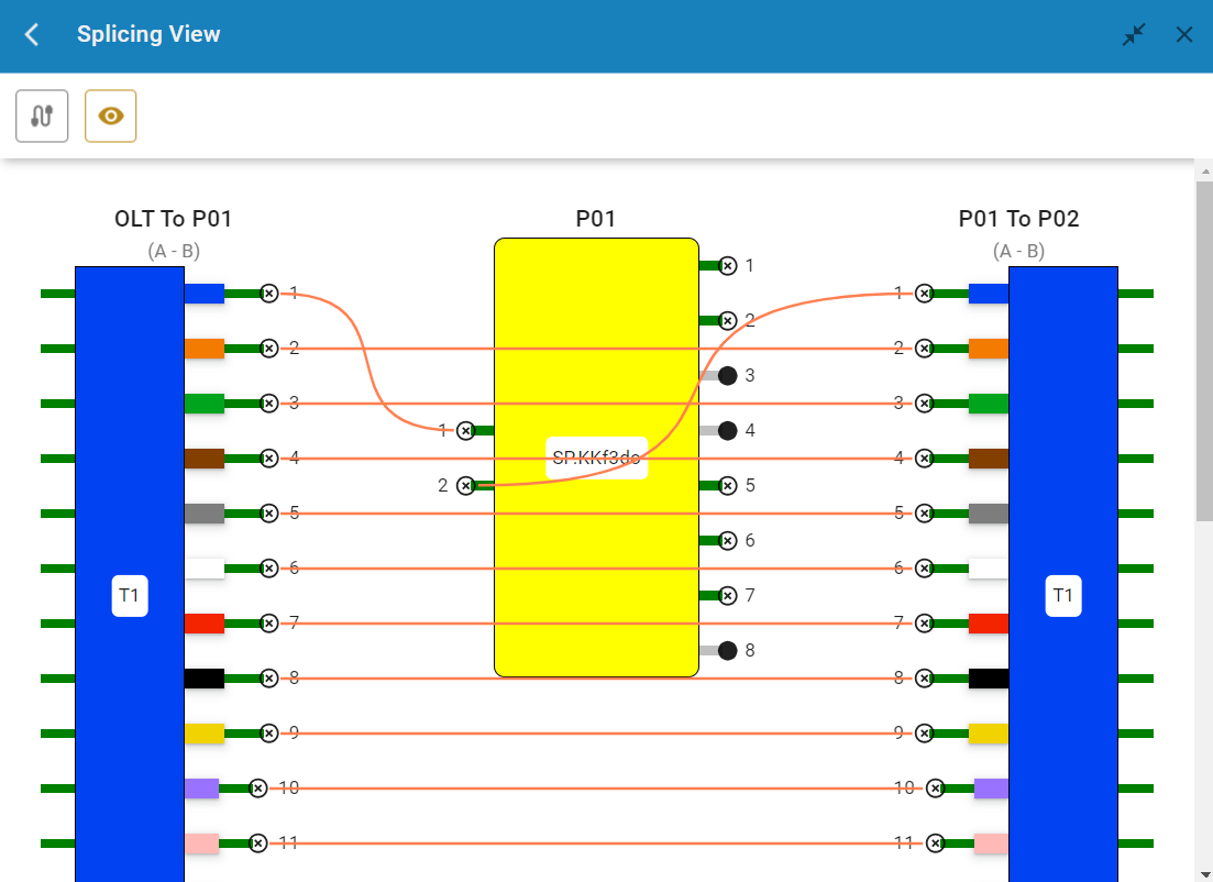
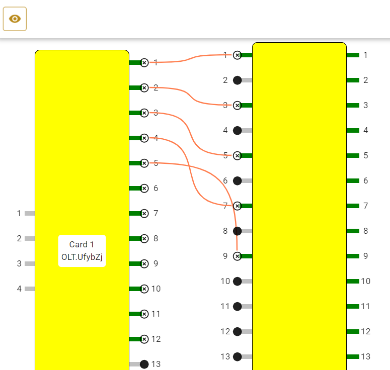
Logical Splicing
After selecting cables, user can do the logical connection between cable by just clicking it. System also prevents user doing any wrong connections based on configured validations.
It also helps user to identify which cable core has active connectivity from its peers.
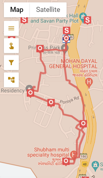
Ring Identification
Based on user inputs and logical connectivity, entire ring architecture can be viewed on the map.
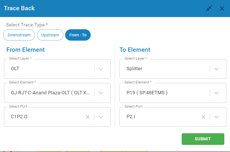
Trace Routes
User can trace the entire routes of connectivity of path through trace option. Multiple options such as uptrace, downtrace, trace between two ends is possible through this tool.
Device and FMS Patching
User can make the logical connectivity between Active device with FMS which has ring connectivity as well.
Home Pass Survey
Task Management Managers to drive the Field team
Mobile Application Features
Tap on Elements, Google Search, Filtering Network Elements, Area Selection, Layer Selection, Adding Network Elements